
by admin | Feb 19, 2013 | Greater New Orleans
It’s not easy to get lost in Plaquemines Parish. There’s one main road that runs down the left side of the Mississippi River and one down the right. Once you get on it, you simply drive straight ahead until you reach the end. We chose Highway 23 on the left side and spent the day exploring our rural neighbor.
 |
| Looking for bugs in the Woodlands Conservancy |
It was late morning before we headed out, jumping on the Crescent City Connection to cross the Mississippi and then exiting nearly immediately at General De Gaulle Dr. The road leads away from the city and high onto a bridge over the Intracoastal Canal, curving back down to drop us in the middle of pasture land. Just a short jaunt from here is Woodlands Conservancy, home to 13 miles of hiking and equestrian trails winding through forests and canals.
Although the 6-mile Bottomland Trail was intriguing with its promise of 10 World War II Ammunition Magazines, we glanced at our 2 and 4-year-old kids and chose the easier 1.1-mile Upland Trail for our own sanity. The recently wet trail, which began by snaking out alongside a canal, was now hardened mud perfectly capturing the footprints of the deer that walked the path before us. Charles, dressed in his entomologist outfit, examined the footprints with his magnifying glass in between chasing the crickets and large mosquitos in hopes of capturing one for his bug catcher.
 |
| Becnel’s Farmers Market |
Soon, the trail veered away from the water and entered the forest, where thousands of yellow flowers blanketed the ground. Being little gentlemen, they picked flowers for their mommy while dad photographed them foraging in a mass of yellow. Every so often, the trail passed a large swamp maple dropping dark red leaves to the ground or a giant cypress standing watch over the smaller trees surrounding it. It was a pleasant, leisurely walk through nature that looped back to the beginning and ended near a pavilion perfect for a post-hike snack.
The food only made our stomachs grumble more, so back in the car and now on Highway 23, we made our next stop Becnel’s Farmers Market. Here, we re-energized on tamales, boudin and alligator sausage, while the kids enjoyed hot dogs from the small food vendor next door. Before continuing on, we browsed the many citrus trees for sale and admired the Blue Angel plane elevated in the air across the street at the Naval Air Station.
 |
| Woodland Plantation |
As we drove south, the land around us thinned, leaving an uneasy feeling of vulnerability. Modest homes intermingled with sprawling refineries in this landscape dominated by fishing and oil. In the midst of this rural community lies the lovely, red-roofed Woodland Plantation, famous for its image gracing the label of Southern Comfort bottles since 1934. We parked by the main house and knocked on the front door, which swung open at our touch. Now a bed and breakfast, the plantation is open for browsing and viewing by anyone who chances by, and we explored each of the cozy rooms filled with antique furniture.
Next door, the old St. Patrick’s Church was moved to this location and now served as Spirits Hall, where six-course dinners are served up to anyone making reservations. The hostess told us how most of the guests were fishermen who stayed overnight before going out on one of the fishing charters arranged by the plantation staff. At the end of the day, the chef cleans and cooks their catch and serves it up in a delicious meal.
The property, including the plantation, received nine feet of water from last year’s Hurricane Isaac, yet you never would have known it. In addition to the main house and church turned dining hall, the beautifully landscaped acreage contained a newly renovated overseer’s house, an old slave cabin currently under repair and the ruins of the sugarcane mill. We strolled the property, at ease to make ourselves at home, while the kids giggled and squealed at the affectionate attention of the home’s cats.
 |
| Fort Jackson |
We had a difficult time persuading them to leave the cats behind so we could continue down the road to Fort Jackson. Built between 1822 and 1832, the fort played a role in the Civil War and stands in a prominent spot overlooking the Mississippi River. Information is hard to come by online regarding the fort’s status, and although last year’s 150th Civil War Anniversary website states that the sight is open daily, we found the gates locked and signs posted saying no public entrance.
We made the most of our time there, though, and walked around the outer wall of the fort, which at times afforded glimpses into the fort’s interior. A monument on the bank of the river denoted the spot where the first Mardi Gras took place in 1699 and another showed a picture of the explorer LaSalle underneath a cross soaring up into the sky. As we walked, something–“perhaps the loch ness monster,” Charles informed us–seemed to follow us in the moat below, leaping into the air every so often to show its large black head.
 |
| Plaque denoting Bayou Mardi Gras with MS River in background |
As the sun lowered, the air chilled and we hurried to reach our final destination – the end of the road. It wasn’t hard to find the flat Tidewater Road only inches higher than the water lapping at its sides. Cypress trees graced both sides of the road, and countless birds perched in their ghostly limbs, making this a prime spot for birding enthusiasts. We even spotted a flash of hot pink and jumped at finding the elusive roseate spoonbill standing silently in the water.
At the end, the road simply disappeared and a sign welcomed us to the “southernmost point in Louisiana,” where another refinery reminded us of the big business dominating Louisiana’s coast. Yet, as unnatural as it looked in that cypress swamp, its presence didn’t deter the thousands of birds sitting along every pipe and building there.
It was dark as we drove back to the city along the same road and encountered a mass of lights floating above the houses to our right. We were shocked to realize it was a cruise ship making its way south along the Mississippi, a city in itself, seemingly hovering in the air beyond the hard-working residents of this parish.
 |
| Two worlds at the end of the road: cypress trees… |
 |
| And a refinery – both covered in birds |

by admin | Jan 29, 2013 | Greater New Orleans
On our evening walks around Uptown New Orleans, we’ve discovered one the best places to take rambunctious kids is Tulane University. We get a little bit of exercise walking there, and they get to jump out as soon as we reach the university and let loose. It’s the perfect place to hunt for cicadas and stick bugs, climb in the rock garden, play in the fountains and chase the stray cats that seem to thrive on campus.
 |
| Carved Stone Head |
As part of our routine, we stop in the Anthropology building for a water and bathroom break and to peak in the main office at the fascinating decorated skeleton occupying the corner chair. During the recent hype over the end of the Maya calendar, a Times-Picayune article came out about a Maya exhibit in this very building we so often frequented. “Faces of the Maya: Profiles in Continuity and Resilience” was hidden two floors above us in Dinwiddie Hall’s Middle American Research Institute.
Normally only open Tuesday through Friday, 10 a.m. to 3 p.m., the museum was fairly inaccessible to us. However, on our latest walk across campus, we decided to ascend the steps to the third floor to maybe catch a glimpse of the exhibit through the window. Luckily, the Institute Director Marcello Canuto must have heard all the ruckus we were making outside his office, and upon discovering what we were up to, gladly opened the museum for us.
It was quite an amazing display depicting the Maya culture, from carved figurines and pottery examples to delicate jewelry and ballgame rubbings. The story of the Maya is intertwined with the artifacts, leading the viewer through the civilization’s earliest existence to today’s descendants who still live throughout southern Mexico, Guatemala, Belize and Honduras.
 |
| Plaster Cast from Palenque God House |
The kids were drawn to a plaster model of El Castillo, a scaled-down version of a Maya temple-pyramid with a series of steps perfectly sized for the butterfly that we had picked up on today’s outing. An accompanying description explained that when the sun hits the platform during the equinox, snakes appear to slither down the pyramid–a sight I can only imagine to be awe-inspiring.
Nearby, I was drawn to a plaster cast of an altar so intricately detailed I could have spent hours staring at it. Alas, as I looked up, the kids were already out the door and headed down the stairs. I briefly stopped one last time to admire a vibrant painting of three Maya men seemingly deep in discussion before darting out the door and shouting a quick “thanks” to Director Canuto.
 |
| Painting of the Maya |

by admin | Jan 15, 2013 | Featured Posts, North Louisiana
From downtown Natchitoches, we took the winding Highway 494 out the east side of town into the rural countryside. Approximately 116,000 acres surrounding Natchitoches make up the Cane River National Heritage Area, which includes several state historic sites, national historic landmarks and the Cane River Creole National Historical Park. The latter is where we were headed, in search of learning more about the Creoles who once thrived in this area.
We had an ambitious day planned, stopping by both plantations included in the National Historical Park, Melrose Plantation in between and then Kisatchie National Forest on the back end of the trip. The route led us first to Oakland Plantation, where we rushed from the parking lot to the nearby pavilion, trying our best to escape the frigid morning air. We picked up a self-guided walking tour and followed the well-defined path toward the tractor shed and mule barn. Not only is the National Park property free to visit, but the scattered out buildings are all open wide for easy touring. We poked our heads inside one building after another, admiring the construction and discussing the old tools and remnants of the past.
 |
| Oakland Plantation Store |
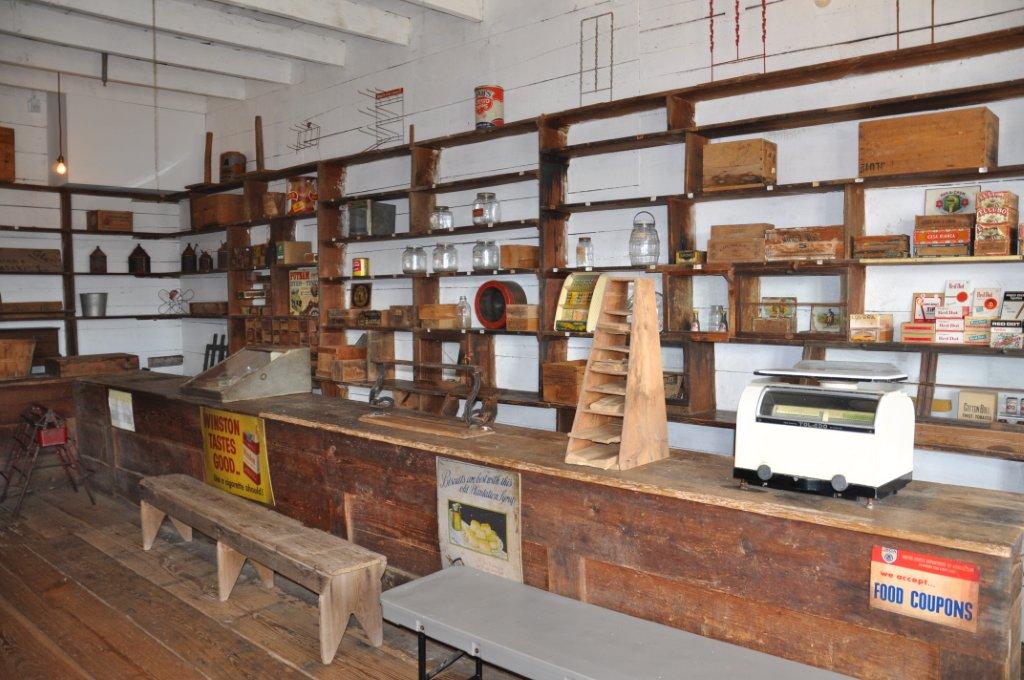
The path steered us toward the old store and post office, which today serves as the Visitor’s Center. Inside, the drafty store held many of the same items available for purchase from when the site was a working plantation. As we poked around, a ranger appeared offering a tour of the main house. Luckily, we were the only ones present at the time, so she adjusted the tour to accommodate the attention spans of a four and two year old. After swearing the kids in as honorary rangers, she showed us the rare and highly guarded bottle garden, where old glass bottles lined the plant beds. We then entered the house, viewing an interesting mix of antique furnishings and modern conveniences such as a TV and “new” kitchen. The ranger told us about the owners, African Americans and Cane River Creoles who once lived and worked here before their property became a testament to the past.
.JPG) |
| Oakland’s Bottle Garden |
 |
| Honorary Ranger Charles |
From Oakland, the road followed the river to Melrose Plantation, significant for the artist colony it once held and the cook turned self-taught artist known as Clementine Hunter. We paid to tour the grounds, and started on the far side of the main house by an abandoned cellar. The kids were overjoyed to find the remains of an armadillo inside, and four-year-old Charles busied himself snapping hundreds of photos with my husband’s iphone. Caught up in his excitement, he dropped the phone inside the doorless building, and Paul was forced to jump through an open window into the pit below to retrieve his phone.
.JPG) |
| Melrose Plantation |
.JPG) |
| Africa House at Melrose Plantation |
Adventure now over, we were able to hustle the kids around to the property’s other historic buildings, such as the Yucca House built between 1796 and 1814 and the highly unusual Africa House and its upstairs Clementine Hunter murals. Hunter’s own small cottage was nearby, another favorite of the children for the lizard that had taken refuge from the cold on her porch.
By now needing lunch, we didn’t stay long at Melrose but were glad we stopped to view this important piece of Louisiana history. The Cane River trail stays true to its past, depicting rural life in the Natchitoches area. Unfortunately for us, this also meant no restaurants in sight. So we scrounged around for the last of our snacks and carried on to Magnolia Plantation, the second of the two National Park properties.
.JPG) |
| Slave Cabin at Magnolia Plantation |
The main house at Magnolia is still privately owned, but the store, a collection of slave houses and a gin barn are all open to the public. Stopping to briefly chat with the ranger inside the Visitor’s Center, he encouraged us to walk the lands and take a look inside the gin at the only wooden screw-type cotton press remaining in its original site. A stack of paper bags lay next to a sign encouraging visitors to gather pecans, so we gave each of the kids their assignment and let them loose. While they competed to see who could find more pecans, we walked around the eight brick slave cabins and viewed the exhibit inside the farthest one. A modified Catholic miraculous medal and several bottles were displayed, evidence of hoodoo rituals and a reminder to me of the Travel Channel’s “Ghost Adventures” show shot here.
.JPG) |
| Kisatchie National Forest |
The ranger had directed us toward a gas station selling sandwiches, where we stopped to refuel both ourselves and the car before crossing I-49 to the Kisatchie Ranger District of Kisatchie National Forest. Home to the 17-mile Longleaf Scenic Byway, the Kisatchie District is touted as one of the most beautiful locations in the state, featuring a landscape of buttes and mesas rarely seen in Louisiana. Shortly into the drive, we stopped at the Longleaf Vista Recreation Area to stretch our legs on the mile and a half interpretive trail.
We were rewarded with a tranquil stream and expansive views of the surrounding wilderness on a surprisingly strenuous hike. Perhaps the difficulty came from carrying kids up and down countless stairs to the flat tops of buttes, but the scenery was well worth the effort. We had even heard rumors that fossils could be found in these hills, but luck was not on our side this time around and we returned only with the pictures and memories from the day’s events.
.JPG) |
| Hiking a Butte at Kisatchie |
.JPG) |
| Sunset at Kisatchie National Forest |

by admin | Jan 8, 2013 | North Louisiana
I’ve wanted to visit the city of Natchitoches ever since first hearing about it in college. The town’s name alone implies someplace special and unique. Dubbed the “City of Lights” in honor of its Christmas light show during the holidays, Natchitoches has been featured in all the regional magazines as one of the must-see Southern towns.
.JPG) |
| View of the Red River from Grand Ecore Visitor’s Center |
I don’t know what took us so long to get there, but we finally booked our hotel and began the four-hour drive northwest over the New Year’s weekend. Despite leaving early, we arrived late Saturday afternoon and took a quick drive-by peak at downtown before heading north to the Grand Ecore Visitor’s Center. Perched on an 80-foot bluff along the Red River, the Visitor Center offers spectacular views as well as a short trail along the bluff’s edge. Inside, various exhibits outline the history of the area, from paleontology and Native Americans to the Civil War and the importance of the Red River. We had made it just before closing time, and the kids had a brief window to try their hands at a simulator where they navigated a ship through a lock in the river.
.jpg) |
| Front Street |
The gate closed behind us as we left the site to drive back into Natchitoches’ historic district. The evening sky was darkening already, and the city’s lights were blinking on over the street and across the banks of the Cane River Lake. Front Street, with its ornate buildings decorated with elaborate cast iron railings, was packed with people mingling about waiting for the last fireworks show of the holiday season. We mingled among them, window shopping through the Christmas-themed display of the 1863 Kaffie Frederick Hardware Store and peaking down alleys and into intimate restaurants.
Chilled from the winter air, we popped inside the Cane Brake Cafe for a late café au lait, “real” chocolate milk and the finest cupcakes I have ever seen, with a giant magnolia icing flower placed delicately on top. After the boys were re-sugarized, we let them loose along the river, where they danced under the fake snow blowing overhead and chatted with horses waiting for their next buggy tour. We made it the full length of the light show before racing back to the car, blowing warm air on our frost-bitten fingers.
.JPG) |
| Lasyone’s Meat Pie |
Cruising Second Street to take in more sightseeing, we spotted the famous Lasyone’s Meat Pie Restaurant. Rarely open past three o’clock, the restaurant had made an exception for the festival, and we landed one of the last tables for the night. To say their meat pies were good is a severe understatement. I’ve tried so-called “authentic Natchitoches meat pies” at several festivals in New Orleans, and they pale in comparison to the real thing. These amazing puffs of beef and pork melt in your mouth and are excellent paired with red beans and rice. My only regret is we didn’t buy a dozen frozen ones to bring home with us. The fireworks began as we exited the restaurant, and with my youngest crying in terror, we packed them into the car and found a church parking lot with a front-row view.
Day two in Natchitoches started at the National Fish Hatchery. Although the main hatchery is closed on Sundays, we tested the front door and discovered the aquarium is apparently open all the time. It was a large room lined with oversized fish tanks and a child-sized viewing platform underneath. My four-year-old snapped dozens of pictures, capturing every fish in the place, while August ran from tank to tank pointing and screaming “fish, fish!” I busied myself with the miniature Caddo Indian village depicting how life would have been for the Native Americans who had once thrived here, several of whom were found in a burial ground underneath the hatchery.
.JPG) |
| Ft. St. Jean Baptiste Historic Site |
Returning to downtown in the daylight, we stopped to view the tops of the recreated 18th century buildings in the Ft. St. Jean Baptiste Historic Site. Unfortunately closed on Sundays, we had to settle with our miniscule look over the back fence and write it on the list for next time. Moving on, we snapped the obligatory photo of the “Steel Magnolias” house as well as pictures of the countless bed and breakfasts up and down nearly every street. Each one was more pristine and beautiful than the previous, and I wondered how anyone chose in which one to stay.
.JPG) |
| Roque House |
At the end of the Cane Riverbank, we found the Roque House, an 1803, Creole architecture home moved to this location in 1967. The large roof of cypress shingles seems to cloak the building underneath, accented by exposed cypress posts placed right in the ground and filled with “bousillage,” a mixture of mud, Spanish moss and animal hair. Amazingly, the entire home was built with no nails.
Behind the house, a massive iron gate stood partially open, inviting us into a small park with a gentle waterfall to the river. We had the place to ourselves, and the kids chased each other back and forth across the bridges. It was our last stop before taking off for the Cane River Creole National Historical Park and Kisatchie National Forest, a journey worthy of its own separate blog.

by admin | Dec 18, 2012 | Greater Baton Rouge
Our latest obsession is fossil hunting. During a recent trip to Percy Quin State Park, we were initially dismayed to find the normally beautiful lake now a drained, muddy bed. We made the most of it, though, venturing out into the squishy mud, collecting a few interesting rocks along the way. Back at home, the discovery of a document by Louisiana State University opened our eyes to what we had before us–rocks filled with imprints of tiny plants and sea creatures from hundreds of millions of years ago.
Now hooked, we had to find more. As it turns out, a good location for Louisiana fossil hunting is in the riverbeds of the Tunica Hills area. Unfortunately, fall is hunting season at Tunica Hills Wildlife Management Area, so we set our sites on neighboring Mississippi’s Clark Creek Nature Area.
.JPG) |
| Our first find |
A two and half hour drive from New Orleans, Clark Creek wasn’t quite close enough to make it without stopping for a sanity break for our 2 and 4-year-old. Pushing through Baton Rouge, we skidded to a halt in St. Francisville on the 400th “are we there yet??” interrogation. A very knowledgeable woman at the Visitor’s Center set us up with a brochure on Clark Creek as well as information on other attractions and, most importantly, food.
Looking for a quick place to pick up lunch, we ordered wraps at Cozy Corner Bistro and walked past the St. Francisville Inn to eat on the picnic tables in the adjacent park. While the kids climbed trees in the park, we glanced down at the Inn’s pebble driveway and discovered the first of the day’s fossils. In under ten minutes, we had found a half dozen river rocks bearing impressions of tiny ferns and marine animals. Giddy with excitement, we loaded back in the car and headed for Clark Creek.
.JPG) |
| Making friends at the Pond Store |
Google routed us along Tunica Trace to the Fort Adams Pond Road, which proved to be a bumpy ride pitted with potholes. Regardless, it was a nice jaunt into the countryside, past pastures of cows and horses and even an old Pond Store, circa 1881.
Just around the corner from the Pond Store was Clark Creek Nature Preserve. We parked alongside a handful of other cars and loaded our backpack with water and snacks. The 700-acre preserve boasts 50 waterfalls, champion trees and miles of hilly, strenuous trails.
.JPG) |
| Clark Creek’s Waterfall Trail |
We set out on the leaf-covered Waterfall Trail, admiring the scenery and listening to the birds chirping. Long rows of stairs bypassed steep slopes that turned slippery in wet weather, and much of the trail had a surprisingly sharp drop-off on one side. At the intersection with the Primitive Trail, we veered off the main trail to walk along the stream’s edge (often having to jump across to switch sides). It was here that we began taking breaks to examine rocks and had already found several interesting pieces when we heard the first waterfall.
Passing beyond a leaning tree, we found ourselves on top of the waterfall, looking down to the pool below. We backtracked through the woods and emerged again on the lower end, marveling at our first sight of a waterfall since the Smokey Mountains. The pool was warm to the touch, and the kids practiced their “mountain-climbing” by jumping across boulders.
.JPG) |
| Exploring the creek bed |
Although the Waterfall Trail leads to six waterfalls, we set our goals on seeing the first two, knowing that we’d most likely be carrying kids on our way out. The second was just as stunning as the first, making us realize the trip would have been a success even without the discovery of fossils.
By the time we made it back to the car, nearly three hours had passed and the sky was darkening with the incoming front. Despite being a bit sore, we were delighted with our day’s adventures through this picturesque nature preserve. Plus, we found plenty of brachiopod, crinoid and tabulate coral fossils for our coffee table’s “show and tell” bowl.


.JPG)

.JPG)
.JPG)
.JPG)
.JPG)
.JPG)
.JPG)
.JPG)
.jpg)
.JPG)
.JPG)
.JPG)
.JPG)
.JPG)
.JPG)
.JPG)